Street Talk: Q&A on Huntsville’s Transportation Infrastructure
Published on

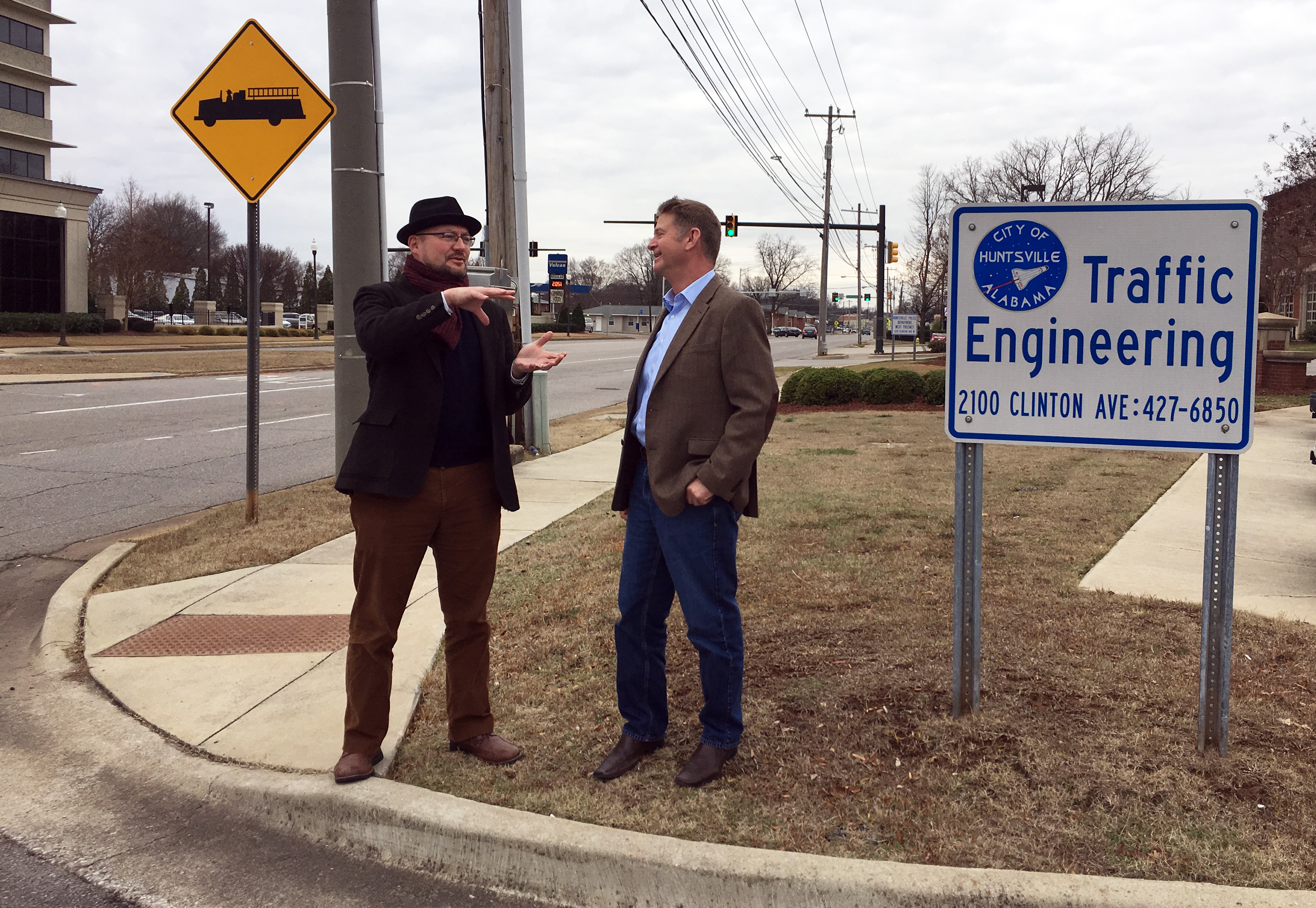
Huntsville is committed to smart growth; reinvesting in neighborhoods and supporting diversified forms of transportation with streets that are safe for walking, biking, and driving. We asked the City’s Traffic Engineering Director Dan Sanders and Long-Range Planner Dennis Madsen to talk about their collaborative approach in managing traffic growth and planning for future transportation options.
(Q) As Huntsville grows, how does the City balance moving traffic with pedestrian and cyclists?
DAN: There is no “one size fits all” answer to traffic facility design and traffic management. In urban core areas, decision-makers need to be looking at emphasizing pedestrian mobility, wherever possible. In order to make streets and intersections more “pedestrian friendly,” certain design features – such as narrower crossings, or a tighter turn radius at intersections – may need to be employed to make crossings for pedestrians safer and more pleasurable. This may work against moving vehicular traffic, though, especially commercial truck traffic. Because of this, decision-makers must look at prioritizing “who are we serving?” in a context-sensitive manner. By the same token, major roadway projects in suburban or industrial areas – while needing to provide for bike facilities – might focus more on moving large volumes of vehicular traffic, and at high speeds. The design and operation of the transportation facilities should depend on the character of the area in question.
DENNIS: Part of the challenge is changing our mindset from looking at streets solely as arteries for moving cars, and instead viewing them as “places” where many activities interact. Keeping a high-functioning traffic network will always be a priority (it’s important to both quality of life and economic development), but with a keener eye on design, we can get so much more out of our road infrastructure. This focus was one of the reasons we pursued (and were ultimately successful in winning) a grant from Smart Growth America to look at how we can implement a “complete streets policy” for Huntsville. As Dan references, such a policy looks at context as the driver for street design. Certain roads (University Drive comes to mind) are always going to be much more about accommodating automotive traffic. Others (Holmes Ave., Clinton Ave, Meridian, Bailey Cove, Whitesburg…) can be developed not only to move cars, but also to safely and comfortably provide for cyclists, and create a pedestrian environment that not only encourages walking but also makes that street a place where people want to BE, not just travel through.
(Q) What is traffic calming and how does the City use it?
DAN: “Traffic Calming” is a set of tools, used by traffic engineers, roadway designers, and planners, to encourage drivers to either drive at slower speeds, or to discourage high volumes of vehicular traffic, on a specific street or streets. Traffic Engineering administers the Neighborhood Traffic Management Program, which applies traffic calming tools to local, residential streets only. Multi-lane roadways and roads with posted speeds of 30 MPH or greater are generally not qualified for the program.
The first streets that had traffic calming implemented utilized devices such as “curb-outs”, small median islands, and traffic circles. These were installed in the Old Town and Five Points neighborhoods in 2001-2004, and were met with mixed reaction from the public. Speed tables started being implemented in 2003, followed by “speed cushions” in 2006, which are greatly favored by emergency response agencies, such as Huntsville Fire & Rescue and HEMSI. These devices are now the City’s speed control devices of choice.
As far as the process goes for retrofitting existing neighborhood streets, a step-by-step description of the program can be found online. To initiate the process, a resident of the street in question should start by filling out this form.
DENNIS: Related to the idea of “Complete Streets,” traffic calming recognizes that as the City has grown and changed, certain routes have taken on more traffic than is comfortable for the surrounding context. In addition to the methods Dan describes, one can “calm” traffic often by providing cues that indicate the presence of other modes (like cyclists and pedestrians) and activities. Improving sidewalks, providing bike facilities, creating pedestrian crossings – even adding things like benches, plazas and outdoor dining areas – sends a signal to drivers that a particular area is meant for many users, and drivers will (often without realizing it) moderate their speed and become more alert.
(Q) What new traffic management techniques are on the horizon?
DAN: For traffic engineers, there are several tools that can be used to more effectively manage traffic. One technique, which is fairly new in Alabama, and which is the policy of the Alabama Department of Transportation (ALDOT), is called “access management.” In many cases, by the time that large residential or commercial developments have been built, and the associated traffic with that development has already begun to load onto adjacent roadways and intersections, it is often too late to try and manage that traffic. Unfortunately, the driveways (accesses) for the developments, and their onsite circulation patterns, are already in place. Driveways may be too close to major, signalized intersections, and gridlock may occur from conflicting movements of traffic at critical points. Poor onsite circulation from the private properties may cause backing up of traffic onto the public roadways, causing major congestion and safety problems.
The best time to manage this traffic is before the commercial or residential development is designed. For large enough developments, Traffic Impact Studies (TIS) can predict – given a site’s land usage type (retail, restaurant, hotel, sporting complex) – where the problems are expected to occur, and how bad they are expected to get. They can show how better driveway placement, or even future adjacent roadway and intersection improvements, can be used to best handle the increased traffic loads from the development in question.
Another traffic management tool that is continuing to be used with more frequency throughout Huntsville includes the “Flashing Yellow Arrow” (FYA) assembly, as pictured below.
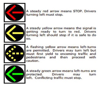
This turn signal has been replacing older “doghouse” style turn signals.
The FYA has been demonstrated nationwide to be more easily understood by drivers than the doghouse style signals, and can allow traffic engineers more freedom in providing more innovative ways of “phasing” traffic signal movements (the order in which they are served at an intersection), which can make for more efficient traffic flow. A recent project utilizing this type of signal includes Governors Drive from Taylor Lane to 14th Street.
(Q) Looking ahead – what direction would you like to see Huntsville take in transportation planning and traffic engineering?
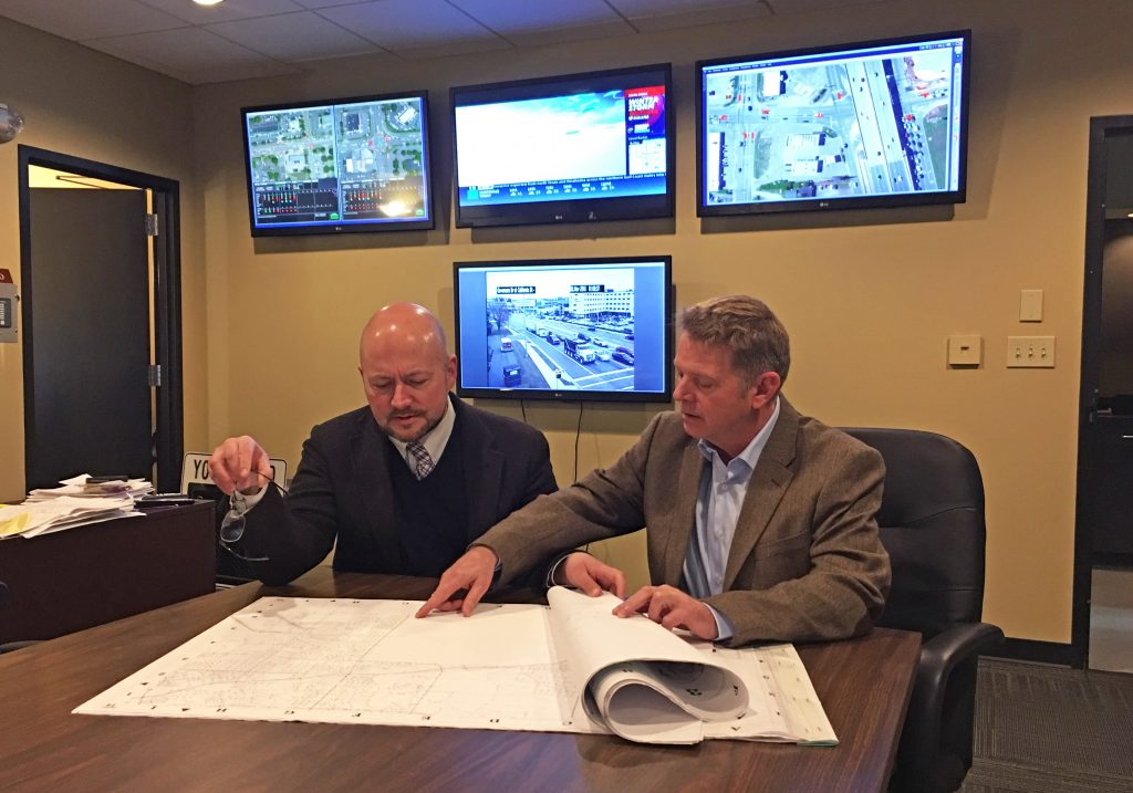
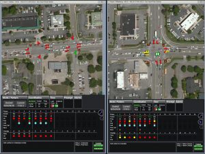
DAN: I would like to see us be more proactive than in the past with respect to access management, continue to replace older doghouse style left-turn signals with flashing yellow arrow assemblies as we have been doing, and continue to make inroads regarding fiber and wireless communication infrastructure for traffic signals. Recently, Traffic Engineering made a purchase of a central software package called “Centracs” (demonstrated in the image below) to allow Traffic Engineering staff to remotely monitor and control signal operation from a central location. Out of about 340 traffic signals, about 75 signals have communications to the Centracs system, and more are anticipated in the upcoming months ahead. As well, this system can be used to more effectively manage winter weather events, such as bridge closures on Memorial Parkway, when traffic is rerouted to the service roads. New traffic signal timing plans would need to be developed in order to do this, and these special plans would be downloaded and implemented by staff during these winter events.
DENNIS: Our goal for 2017 is to implement the Complete Streets policy, as part of the grant requirements, and at the same time monitor how technology is changing the way we move around our community. Rideshare services like Uber; modern transit like Bus Rapid Transit (BRT); autonomous vehicles – the question is not if technology will change transportation; the question is when, and whether or not we’ll be prepared to take advantage of it.