Heel and Crank Duathlon to impact traffic near Explorer Boulevard June 6
Published on
The Huntsville Police Department (HPD) will assist with traffic control for the Heel and Crank Duathlon on Saturday, June 6, resulting in temporary traffic impacts near Explorer Boulevard.
Road closures and traffic restrictions will begin at 7 a.m. and are expected to remain in place until around 11 a.m.
Drivers can expect the following traffic impacts:
- Westbound traffic on Discovery Drive from Mark C. Smith Drive
- Mark C. Smith Drive
- Eastbound traffic on Moquin Drive at Genome Way Northwest
- Northbound traffic on Discovery Drive from Explorer Boulevard
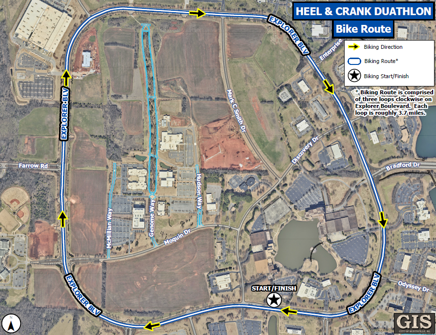
The cycling portion of the event will take place on Explorer Boulevard. Traffic cones will separate the roadway, directing vehicle traffic to the outer loop while allowing participants to safely use the inner loop.
HPD officers will be stationed at key intersections throughout the course to assist motorists and ensure the safe movement of participants.
Drivers are encouraged to use caution when traveling in the area, allow extra time for travel and remain alert for cyclists, officers and traffic control devices.
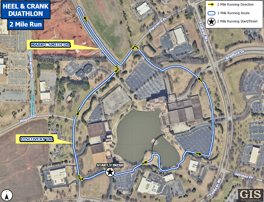
2-mile run:
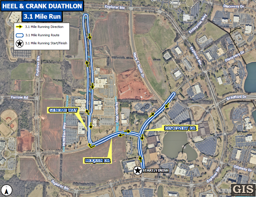
3.1-mile run:
Bike route: